University Libraries
Government Documents Get a Second Life
By Maureen Schlangen
In the summer of 2018, the University Libraries deaccessioned hundreds of U.S. Geological Survey topographic maps as part of an ongoing collection review known as "weeding." Because the maps and thousands of other government documents are now available digitally, the Libraries no longer needed to keep the paper versions, and with a full floor of the library gutted for renovation, space was at a severe shortage.
No other libraries having come forth to acquire the maps, they were destined for discard. I asked if I could take some of them home to use as wrapping paper and to make gift bags out of them … but as far as I knew, I was the only one with any interest in them.
About a week later, during a visit to Greenville, South Carolina, I was browsing through the artist studios and galleries in an area of downtown called Art Crossing and encountered one of these very maps in a piece of artwork.
Meaning behind the medium
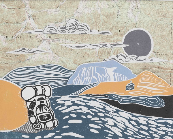
The artist, Douglas Piper, specializes in linocut printmaking, a form of relief printing in which he carves images into linoleum block, applies ink to the surface and then transfers the ink under pressure onto another surface. Piper was in the studio working that afternoon, and we struck up a conversation. The map, from the 1940s, belonged to his grandfather, the late Clair Harold Hunt, a veteran of the U.S. Army Air Corps whose hobbies included photography, woodworking, carving and painting.
"I wanted to find a way to honor my grandfather, as he was a big part of why I've pursued artwork," Piper said. "The tools I use are my grandfather's old wood-carving tools."
While Piper's work includes a variety of subjects, much of it depicts the outdoors, and when it's arranged over a topographic map, it creates an immersive effect.
"People really enjoy my prints with the maps because it immediately takes them to a place in their imagination," he said. "They love the double use of having the artwork and adding the extra element of the map. I try and use maps that relate to the artwork as well."
Unfortunately, his supply was limited.
"I only have so many, and I don't want to use all of them," he said.
Idea: Upcycle
When I got back to campus, I asked Dean Kathy Webb and information resources specialist Scott West if I could send Piper some of our deaccessioned maps. Since no other libraries had requested them, they gave me the green light. A few weeks later, the first batch of about 100 arrived at the studio. Another set arrived about a month after that. Piper said he was both grateful for the materials and delighted to give the maps a second life while he expands his body of work.
"I have a few more ideas, but they need to be developed more," Piper said. “This winter has given me a great opportunity for experimenting."
More about the artist
Piper, a Greenville native, is a 2009 graduate of Clemson University. Check out his work online and on Instagram.
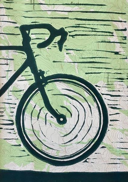
"Roadie" by Douglas Piper
In this work, Piper applied the ink directly on a USGS topographic map.
"Roadie" by Douglas Piper
In this work, Piper applied the ink directly on a USGS topographic map.
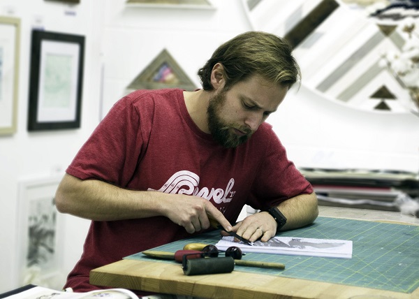
Douglas Piper in his Greenville, S.C., studio
Piper uses gouges and other tools that belonged to his grandfather to carve an image into a block of linoleum.
Douglas Piper in his Greenville, S.C., studio
Piper uses gouges and other tools that belonged to his grandfather to carve an image into a block of linoleum.
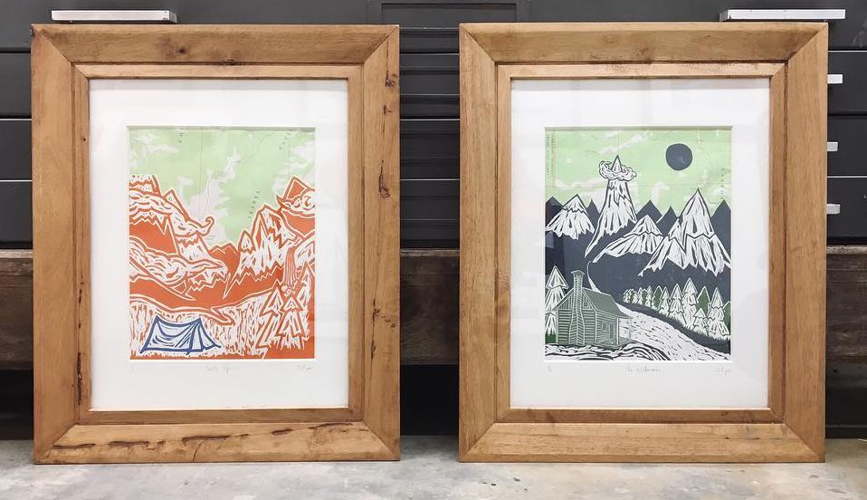
Print collages
"Tent's Up" and "The Wilderness" are collages of linocut prints arranged on U.S. Geological Survey topographic maps.
Print collages