Blogs
Mapping the Media Cityscape of New Orleans
By Robert Joseph, Ph.D.
This article appeared in Mediapolis no. 4, On Teaching, Student Voices, vol. 6 on
Mapping Cityscapes emerged from SSC 200, an interdisciplinary social science course required of all University of Dayton (UD) undergraduates. Though the course must fulfill the student learning outcomes (SLOs) and align with three of UD’s social science departments (Anthropology, Communication, Economics, Political Science, Psychology, Sociology), each course’s section is designed by instructors to fit their interests and academic backgrounds. With my background in film and cultural studies and my interest in cityscapes in film and television, I proposed an SSC 200 section titled “Mapping Cityscapes in Media.” Aligning the course with Communication (my own department), Economics, and Sociology, the course aims for students to better understand the relationship between on-screen representation of an American city and that city’s sociological reality. The course culminates in a mapping project assignment in which students map the production locations of a film or television series and analyze how those locations inform the city’s representations. The course was proposed in Spring 2019 and, after a summer workshop, was approved for the Spring 2020 semester.
Over the three semesters I taught SSC 200, I continued to adjust the syllabus and course focus, building on what I thought worked well while adjusting ineffective assignments and lessons. While instructors are encouraged to design their lessons on their chosen focus, the SLOs for the class are for students to be able to locate, understand, and utilize social science research. This dual emphasis on flexibility of structure and set-in-stone SLOs requires a balancing act that every SSC 200 instructor must navigate on their own. For my own syllabus, I started the semester with a screening of a media text to stimulate their interest in the media studies aspect of the course, before pivoting back to lessons on my three social science disciplines and how to identify, read, and find social science scholarship. After these requirements are completed, culminating in a midterm and an annotated bibliography, the focus pivots to the mapping portion of the course. During class workshops and on their own time, students find locations that appear in their chosen film or TV episodes, using a shared Google Map to map their locations and analyze the significance of their appearances on-screen. This research and analysis was intended to culminate in student presentations spread across the final weeks of the semester, until the outbreak of COVID-19 necessitated the closing of campus and “pivot” to online learning. For Mapping Cityscapes in Media, this pivot led to an adjustment to the requirements of the final presentation to allow for either a video or a PowerPoint submitted with accompanying audio or written notes with each slide. Due to UD going all-remote after Thanksgiving the following Fall semester, Spring 2021 was the first time I was finally able to see my students present in person.
For the first semester that I taught this course, the section was not grounded in a specific location; each student made their own maps, which limited their ability to analyze the significance of their locations. For Fall 2020, I allowed each “half” of my class (I split my section into Tuesday and Thursday sections for social distancing purposes) to choose their own cities to focus on (they respectively chose Los Angeles and New York). One of the unexpected challenges that emerged during this section was my realization that Google Maps only allowed for ten different layers, necessitating the sharing of layers so that each media text could appear on the same map. Though it came with challenges, the adjustment to one map improved the quality of their analysis and allowed them to compare their text’s locations to those that appeared in other film and TV. However, I still felt that the class spoke of urban development and media production too generally, not allowing me to account for the dynamics that are specific to a single urban location. For this reason, I decided to focus my Spring 2021 section entirely on film and TV set in New Orleans, the subject of my dissertation and one of my primary academic focuses.
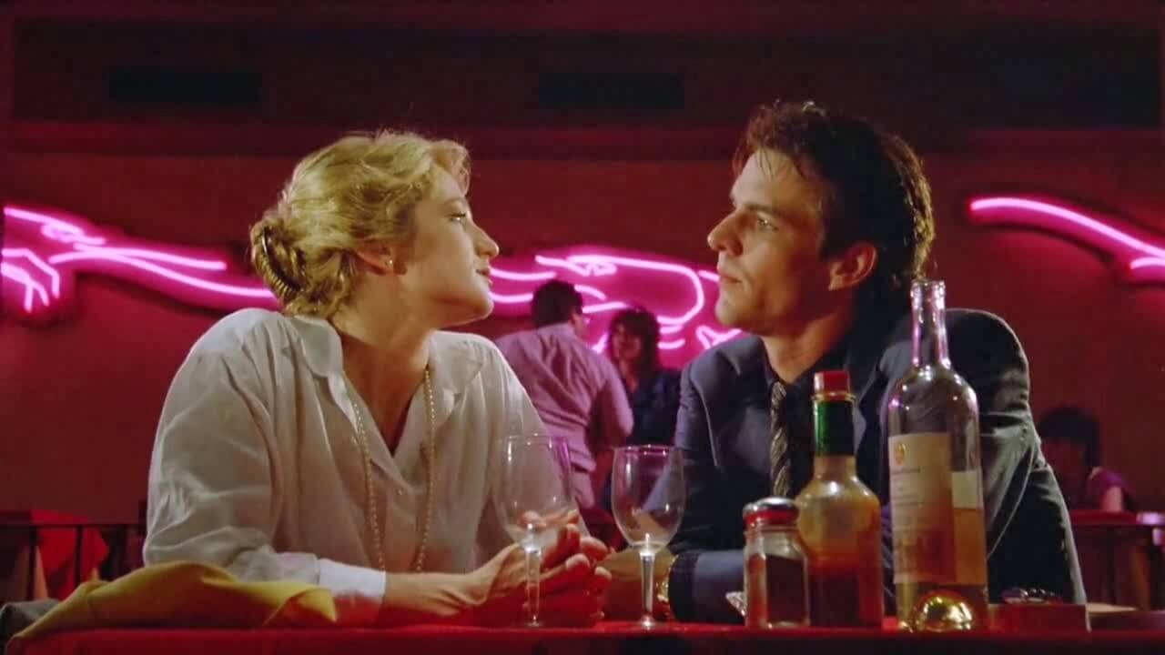
For this semester, I constructed a syllabus that balanced a sociological history of New Orleans with its recent ascension as a center of film and TV production, along with incorporating mapping methodology and film theory to enhance the analysis of their chosen texts. I started by screening The Big Easy (Jim McBride, 1986), a film still notorious among New Orleanians for its cultural excesses, but which stereotypes, distorts, and critiques the city in significant and compelling ways. So that my students could begin to understand a place known for its cultural density that most of my students have never visited, I assigned readings by New Orleans scholars, including Richard Campanella’s geographic studies of the city’s gentrification and “coolness,” Andy Horowitz’s history of Hurricane Katrina, and Ana Croegaert’s anthropological study of the city’s removal of Confederate monuments. So that my students understand how their text’s representation is related to a given era’s context of production, they were assigned the chapter in Joshua Gleich and Lawrence Webb’s edited collection Hollywood on Location that aligned with their era of film production history, while those analyzing a TV show were assigned a chapter from Glen Creeber’s Small Screen Aesthetics. As a basis for our mapping projects, we spent a week looking at the University of Cambridge’s Battersea Project, analyzing select clips from Battersea-set films and using their map of represented locations in that London neighborhood as a basis for their own mapping of New Orleans. To frame their analysis within film theory, I taught the realism/classicism/formalism spectrum drawn from Siegfried Kracauer’s Theory of Film (1960), requiring my students to consider their text’s place on the spectrum in relation to the mode of production they were analyzing (blockbuster vs. independent, romantic comedy vs. action movie, etc.). Finally, in addition to revisiting The Big Easy as a base of understanding New Orleans’ history of representation, I demonstrated intersections of production and location through showing and analyzing clips from disparate New Orleans-set feature films like Saratoga Trunk (Sam Wood, 1946), Panic in the Streets (Elia Kazan, 1950), A Streetcar Named Desire (Elia Kazan, 1951), Easy Rider (Dennis Hopper, 1969), Streets of Blood (Charles Winkler, 2006), Déjà Vu (Tony Scott, 2006), Now You See Me (Louis Leterrier, 2013), and Chef (Jon Favreau, 2014); documentaries like Trouble the Water (Carl Deal and Tia Lessin, 2008) and Big Charity (Alexander Glustrom, 2014); and TV series like Treme (HBO, 2010-2013) and American Horror Story: Coven (FX, 2013-2014). The culmination of this semester-long analysis of New Orleans’s on-screen representations was a Google Map of locations used in each film and TV episode, along with a collection of fascinating, compelling presentations.
The variety of film texts explored by my students are testament to the diversity of both New Orleans’s representation and my students’ cinematic interests. Several presentations demonstrated significant scholarly engagement and creativity in their analyses of their media texts. These include an analysis of how the pilot of Treme (HBO, 2010-2013) attempted to convey an authentic picture of the titular neighborhood post-Katrina and the relationship of that representation’s appeal to gentrification; how NCIS: New Orleans (CBS, 2014-2021) unexpectedly veers into a realist lens in its accurate portrayal of tourism foot traffic in the French Quarter; a detailed analysis of the accuracy in the post-Katrina damage in the Algiers neighborhood in Bad Lieutenant: Port of Call New Orleans (Werner Herzog, 2009); and how the on-screen supernatural conflict within the French Quarter and the Garden District in The Originals (The CW, 2013-2018) reflect the city’s off-screen trends of post-Katrina displacement. Among these students, the student who distinguished herself with engaged, detailed scholarship is Sharifah Nadeen Abouzarah with her analysis of Remember Sunday (Jeff Bleckner, 2013). Analyzing a little-seen Hallmark TV-movie romance about a waitress (Alexis Bleidel) who falls in love with a jewelry store worker (Zachary Levi) with short-term memory loss, Nadeen brings to light a remarkable paradox: a Hallmark movie that eschews the romantic tourist image that overwhelms so much of New Orleans film and TV. By analyzing the film’s usage of the areas of the city where New Orleanians actually live and work in their day-to-day lives, Nadeen demonstrates unexpected realist tendencies in Remember Sunday. Her presentation demonstrates what I found in the best student scholarship in Mapping Cityscapes, in which a careful mapping and analysis of a properly contextualized media text can reveal unexpected insights about how a city’s identity is constructed in film and television.
Robert Joseph, Ph.D. is a lecturer in the Department of Communication at the University of Dayton. His teaching interests include introductory communication, film history, media effects, and media geography. His research interests include cinematic geography, New Orleans, and American film and TV as cultural artifacts. His work has been published in The Projector and The Smart Set.
Mapping Cityscapes
SSC 200 Course Presentation
New Orleans Geographical Representation in the film Remember Sunday.
Mapping Cityscapes
New Orleans Geographical Representation in the film Remember Sunday.
SSC 200 Course Presentation